
| Specifications | Site Link(s) | |
|---|---|---|
| Maps of Croatia and Bosna-Hercegovina An enormous database of road maps of Croatia and Bosna-Hercegovina. |
Maps of Croatia & B-H | |
| Auto Karta Hrvatske Auto Karta Hrvatske - Najprecizniji satelitski prikaz karte |
Auto Karta Hrvatske | |
| Interaktivna karta Hrvatske | Interaktivna karta Hrvatske | |
| Adria Navigator Your Adriatic compass. Nautical information for Croatia. |
Adria Navigator | |
| Maps and related drawings Over the years of the war in my homeland, I created numerous maps, drawings, graphics which I used for publications and lectures. Here is a collection which may be of use to you. |
Maps and related drawings | |
| Interaktivna karta Hrvatske | Interaktivna karta Hrvatske | |
| CroMaps navigator The portal will as its main feature present a set of searchable city maps |
Hrvatski Deutsch English | |
| Interactive Croatia Travel Map Hotels in Croatia, apartments in Croatia, villas in Croatia,tourist attractions, tourist boards officies, croatia national parks,airports in |
Interactive Croatia Travel Map | |
| Karte Hrvatske: Gradovi Maps of Croatia: Cities |
Hrvatski English | |
| Geografija.hr Zemljopis, karte, atlasi, fotografie Hrvatske. |
Geografija.hr | |
| Interaktivni atlas Hrvatske Interactive maps of Croatia |
Hrvatski | English |
| Tourist panoramic map Turistički panoramski zemljovid Hrvatske. |
Tourist panoramic map | |
| Croatia in Europe Where Croatia lies in the grand scheme of things. |
Croatia in Europe | |
| Croatia, topographic map JPEG, 856 x 920 pixels showing elevation in Croatia. |
Croatia, topographic map | |
| Croatia - The Perry-Castaneda Library Map Collection Excellent map of Croatia in Her present borders (218K JPG, 1396x1492 pixels). |
Map Mirror Mirror | |
| Map of Croatia | Map of Croatia | |
| CNN Map of Croatia JPEG image 400x389 pixels |
Map of Croatia | Map of Croatia |
| Map of Croatian Regions | Croatian Regions Map | |
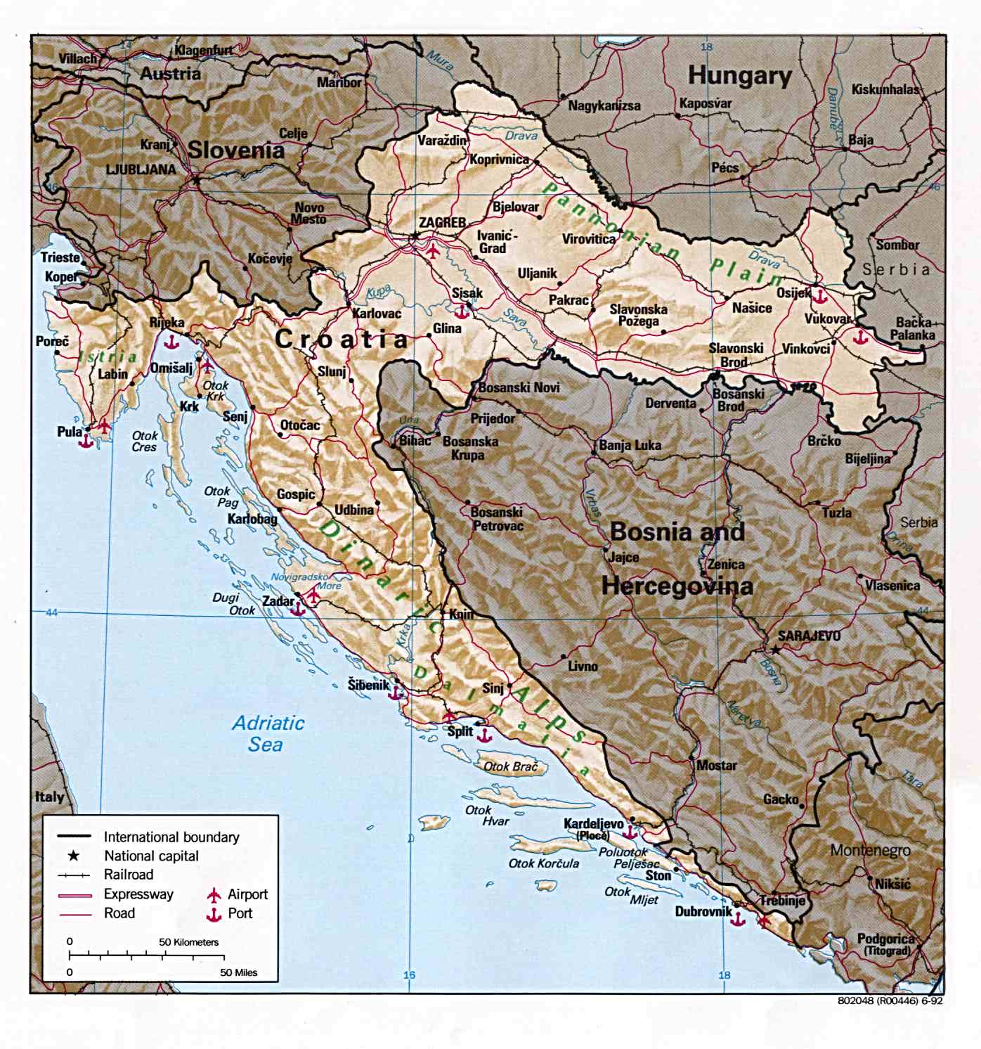
| Map of Bosnia, Croatia and Slovenia 543K detailed map of Slovenia, Croatia, and B-H. (1274 x 1382 JPEG) |
Map of B-H, Cro and Slo | |
| Political Map of Bosnia, Croatia and Slovenia 319K detailed map of Slovenia, Croatia, and B-H. (1064 x 1076 JPEG) |
Map of B-H, Cro and Slo | |
| Political Map of Bosnia, Croatia and Slovenia 131K detailed map of Slovenia, Croatia, and B-H. (1018 x 1026 JPEG) |
Map of B-H, Cro and Slo | |
| Croatia 351 x 377 GIF of Croatia with major cities. |
Croatia | |
| Maps of Croatia Maps of 12707 towns and cities in Croatia. |
Croatia | |
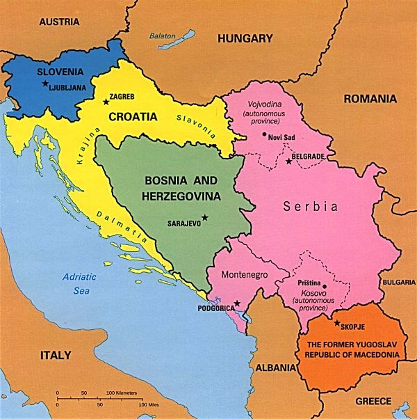
| Colour map of the former yugoslavia JPEG image 600x602 pixels |
Map of former yu | |
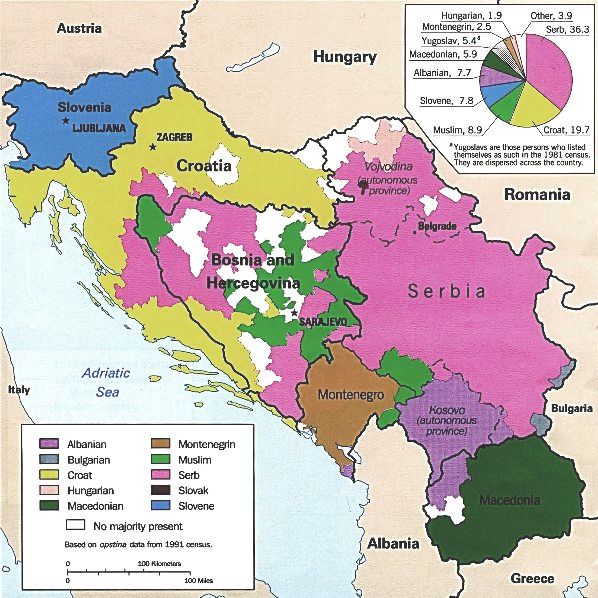
| Ethnicity Map of former yugoslavia Based on data from the 1991 census. JPEG image 598x598 pixels |
Ethnicity Map of former yu | |
| Maps of former zugoslavia Small GIF images that can be used on web sites. |
Maps of former Yugoslavia | |
| Planovi hrvatskih gradova | Planovi hrvatskih gradova | |
| Karte po Hrvatskoj | Karte po Hrvatskoj | |
| Karte Hrvatske Sve karte dane su kao ArcInfo/ArcView fileovi u zip formatu. |
Karte Hrvatske | |
| Maps of Republic of Croatia | Maps of Croatia | |
| Zemljovid Republike Hrvatske | Zemljovid Hrvatske | |
| Zbirka planova i karata Zbirka planova hrvatskih gradova i karte hrvatskih regija |
Zbirka planova i karata | |
| Croatian city maps Download maps for various Croatian cities here, view them in Adobe Acrobat. |
Croatian city maps | |
| MapQuest: Croatia Izvanredno za karte Hrvatske i cijeloga svijeta. |
MapQuest: Croatia | |
| Map of Eastern Croatia PDF map created by the UN. |
Map of Eastern Croatia | |
| Map of Croatia PDF map created by the UN. |
Map of Croatia | |
| Map of Croatia | Map of Croatia | |
| Map of Croatia JPEG image, 1396x1492 pixels, outlining major cities |
Map of Croatia | |
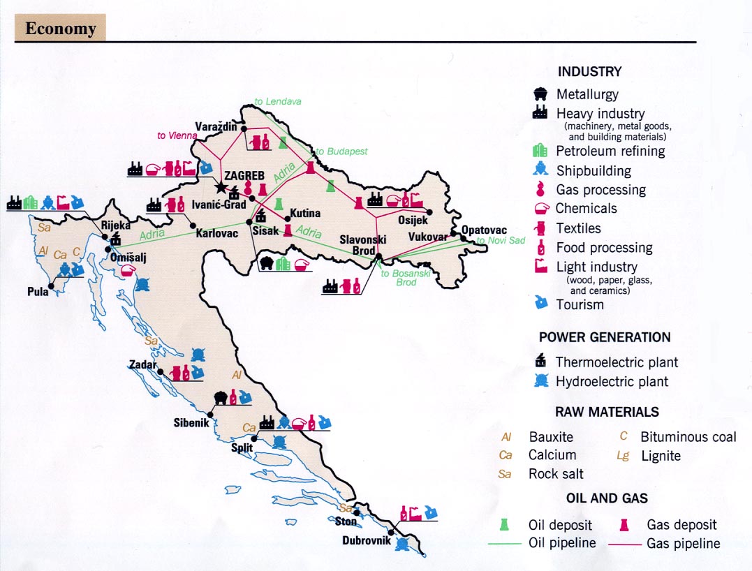
| Map of Croatia - Economy 1992 JPEG image, 1077x818 pixels, showing major industry throughout the country. |
Map of Croatia - Economy | |
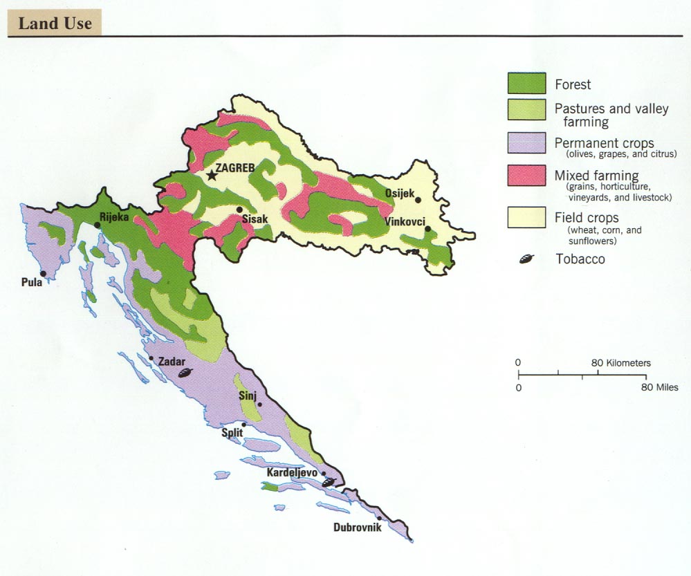
| Map of Croatia - Land use, 1992 JPEG image, 999x833 pixels, showing how land is used throught Croatia. |
Map of Croatia - Land use | |
| Excite Travel Guide: Map of Croatia | Map of Croatia | |
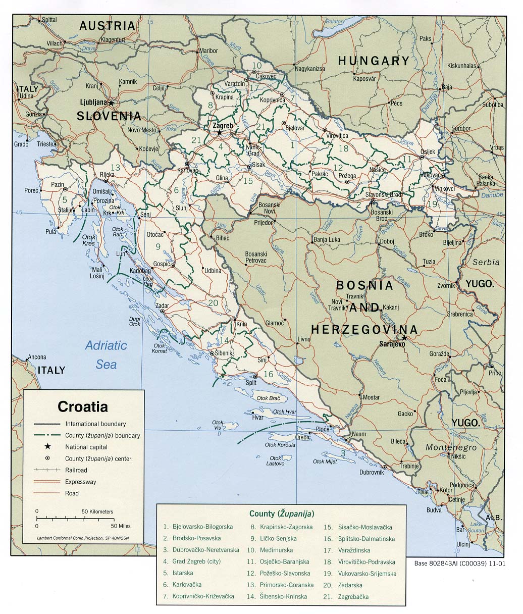
| Croatia - Political map, 2001 JPEG image, 1036x1216 pixels, showing Croatia and the countries it borders, major cities and road links, županije borders. |
Croatia - Political map | |
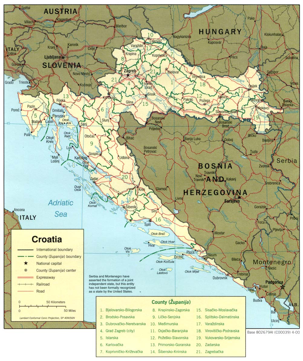
| Croatia - Political map, 2000 JPEG image, 1002x1195 pixels, showing Croatia and the countries it borders, major cities and road links. |
Croatia - Political map | |
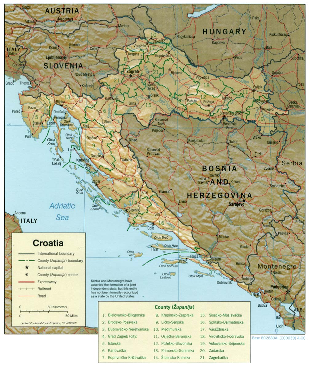
| Croatia - Relief Map, 2001 JPEG image, 1036x1226 pixels |
Croatia - Relief Map | |
| Croatia - Relief Map, 2000 JPEG image, 1008x1206 pixels |
Croatia - Relief Map | |
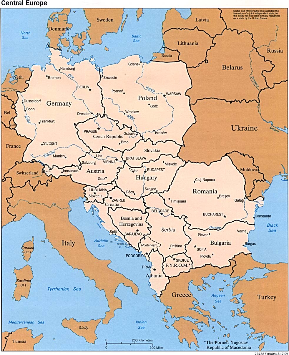
| Central European Political Map, 1996 JPEG image, 982x1206 pixels |
C. European Political Map | |
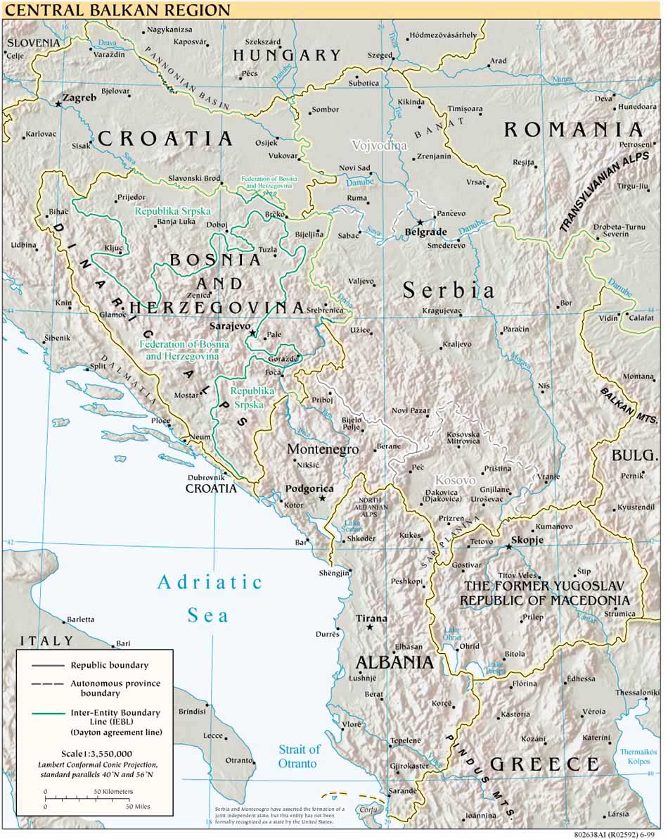
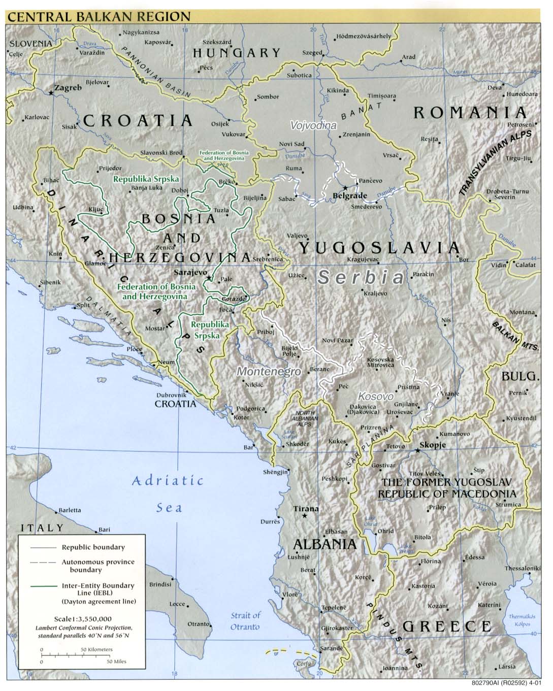
| Central Balkan region map, 1999 JPEG image, 950x1192 pixels |
Central Balkan region map | |
| Central Balkan region map, 1999 Similar to above map, in PDF format |
Central Balkan region map | |
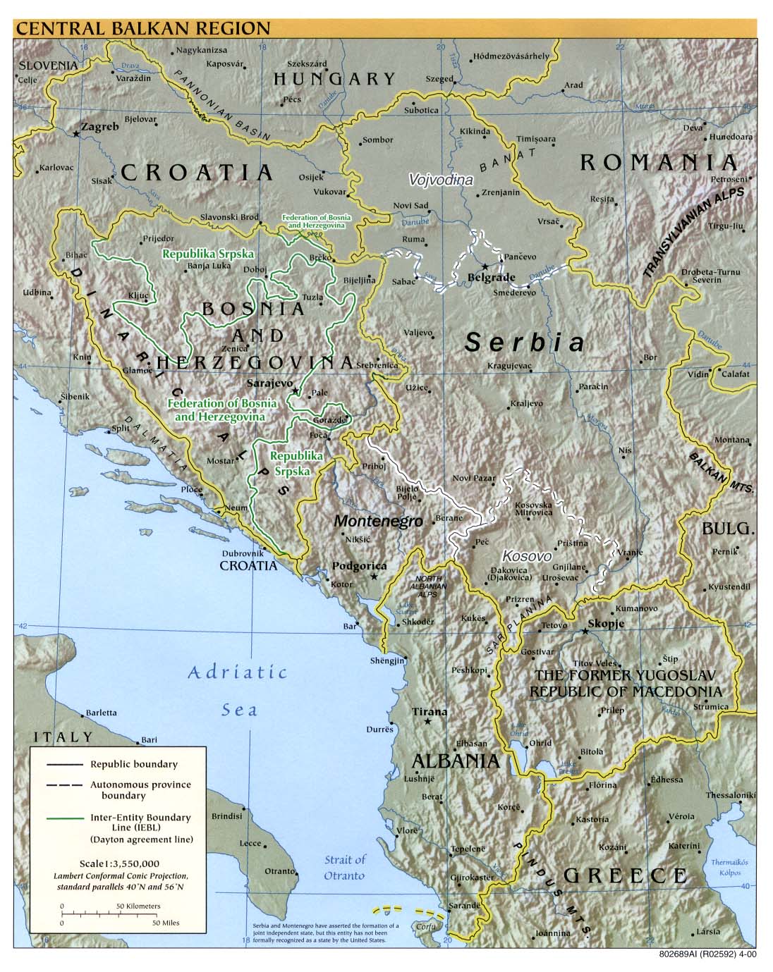
| Central Balkan region map, 2000 JPEG image, 1096x1379 pixels |
Central Balkan region map | |
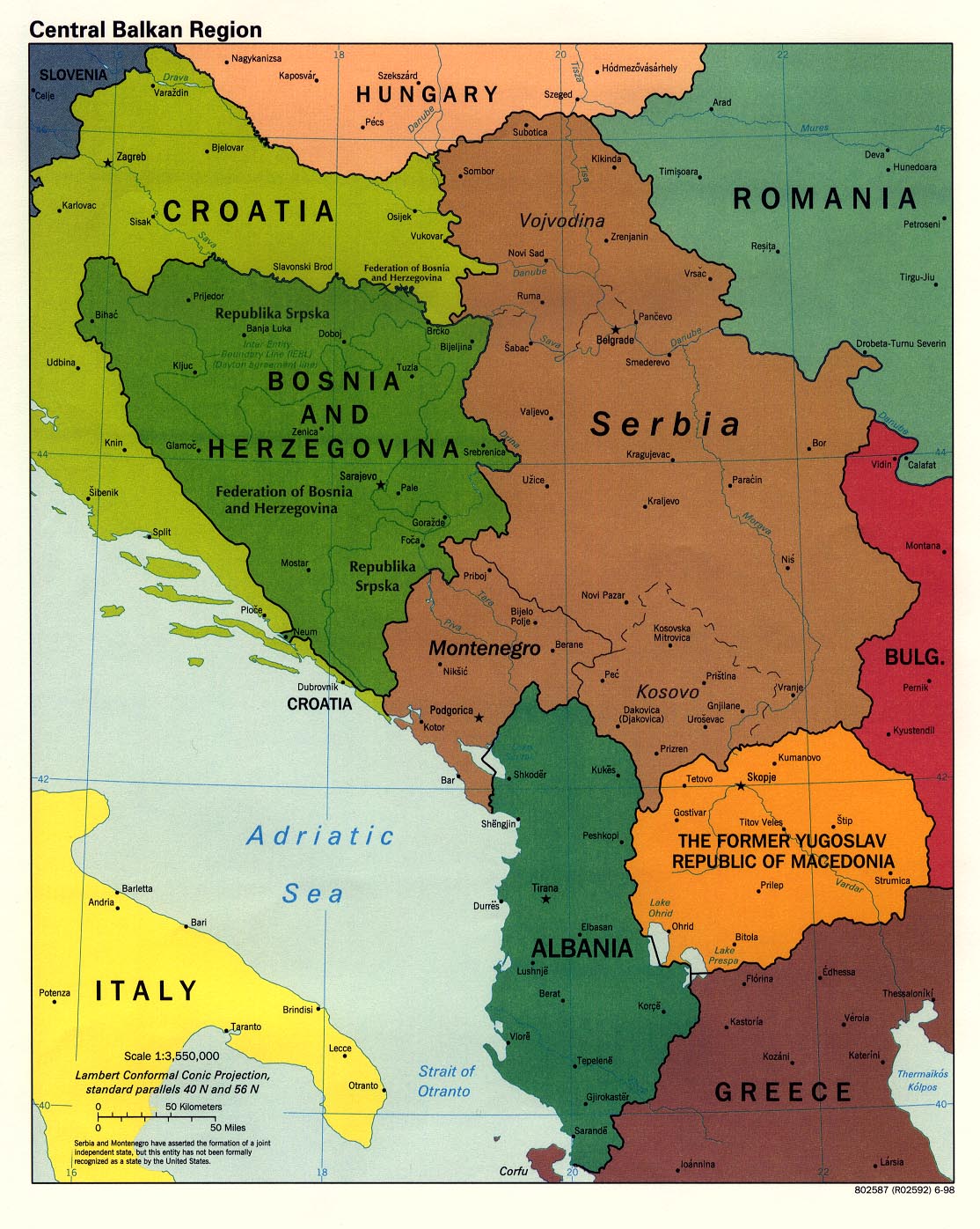
| Central Balkan political map, 1998 JPEG image, 1114x1396 pixels |
Central Balkan political map | |
| Central Balkan relief map, 2001 JPEG image, 1089x1361 pixels |
Central Balkan relief map | |
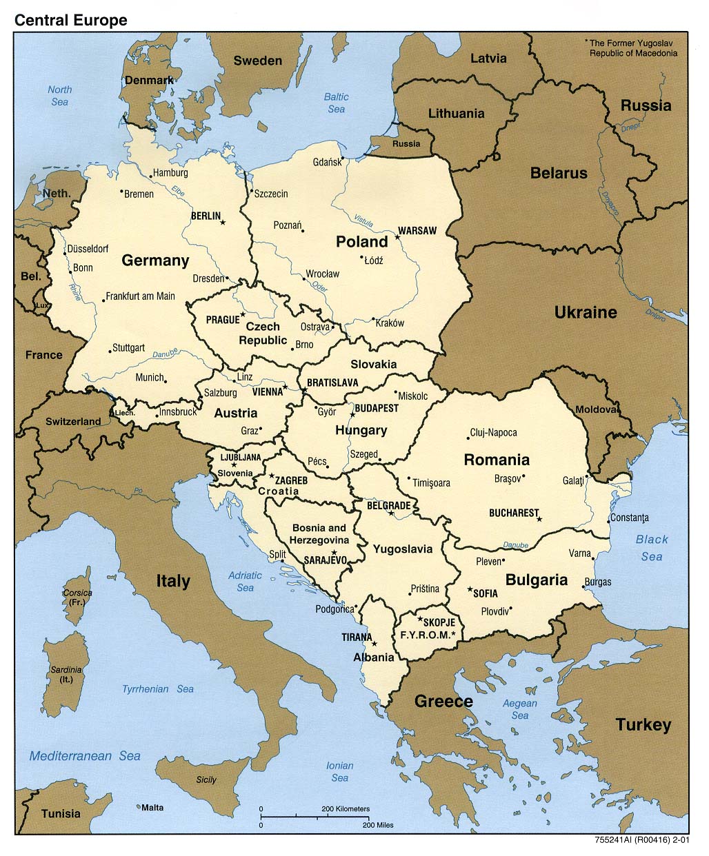
| Central European Political Map, 2001 JPEG image, 1028x1242 pixels, showing |
Central European Political Map | |
| Central Balkan relief map, 2000 Similar to other maps, in PDF format. |
Central Balkan relief map | |
| Central Balkan relief map, 2001 Similar to other maps, in PDF format. |
Central Balkan relief map | |
| Central European Political Map, 1996 JPEG image, 1084x1282 pixels |
Central European Political Map | |
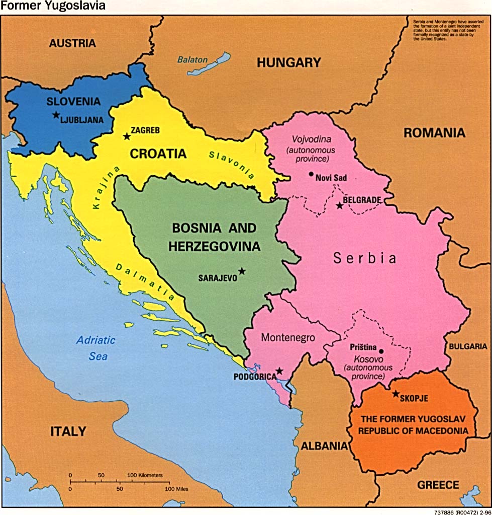
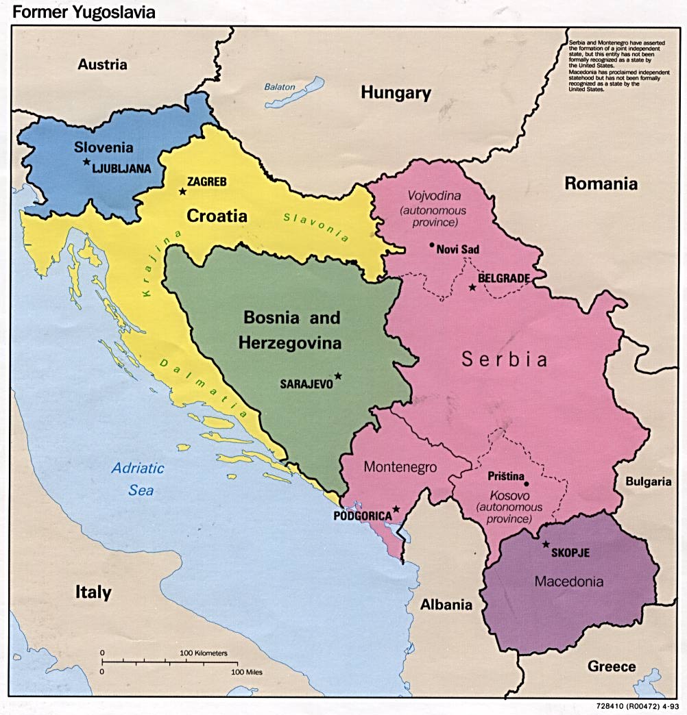
| Former yugoslavia Political Map, 1996 JPEG image, 979x1023 pixels |
F-yu Political Map | |
| Former yugoslavia Political Map, 1995 JPEG image, 1018x1026 pixels |
F-yu Political Map | |
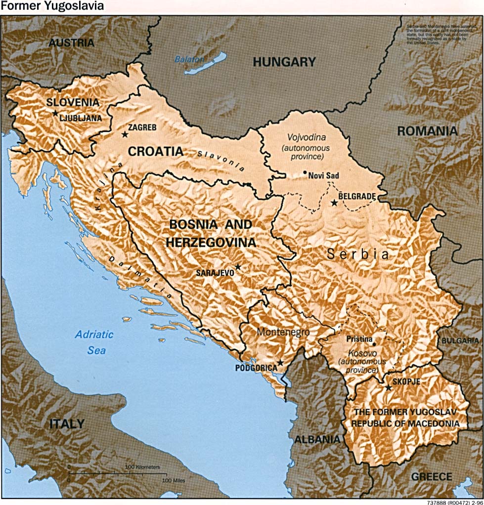
| Former yugoslavia Relief Map, 1996 JPEG image, 979x1022 pixels |
F-yu Relief Map | |
| Former yugoslavia JPEG image, 1002x1044 pixels |
F-yu | |
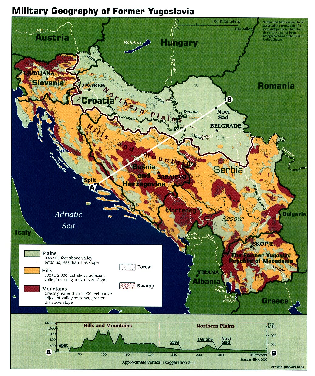
| Military Geography of former yugoslavia, 1998 JPEG image, 1038x1238 pixels |
Military Geography of f-yu | |
| Croatia relief map, 2000 PDF file |
Croatia relief map | |
| Croatia relief map, 1992 PDF file |
Croatia relief map | |
| Croatia relief map, 2001 PDF file |
Croatia relief map | |
| Croatian population density map, 1996 JPEG image, 917 x 690 pixels |
Croatian population density map | |
| Croatian population structure chart, 1996 JPEG image, 381 x 689 pixels |
Croatian population structure | |
| Croatian political map, 2000 PDF file |
Croatian political map | |
| Croatian political map, 2001 PDF file |
Croatian political map | |
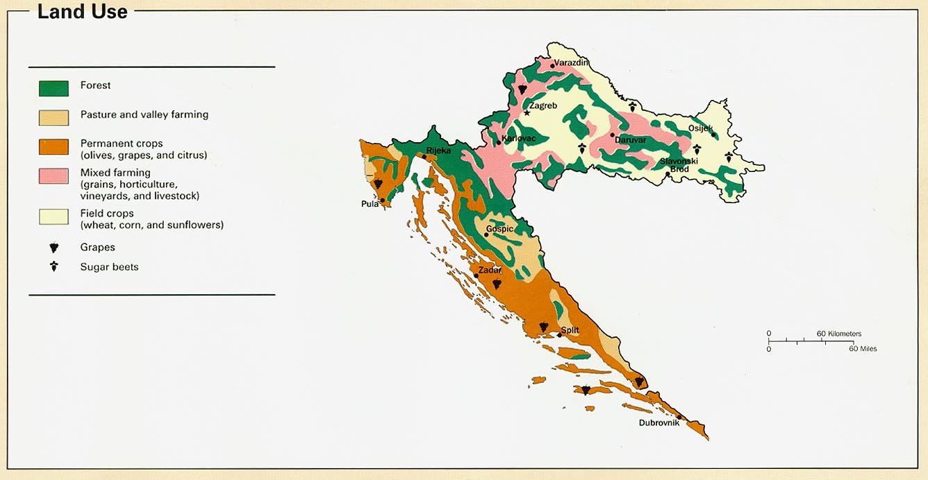
| Croatia land use map, 1996 JPEG image, 1336 x 692 pixels |
Croatia land use map | |
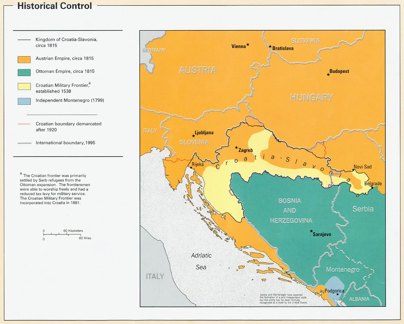
| Croatian historical control map, 1996 JPEG image, 1328 x 1063 pixels |
Historical control map | |
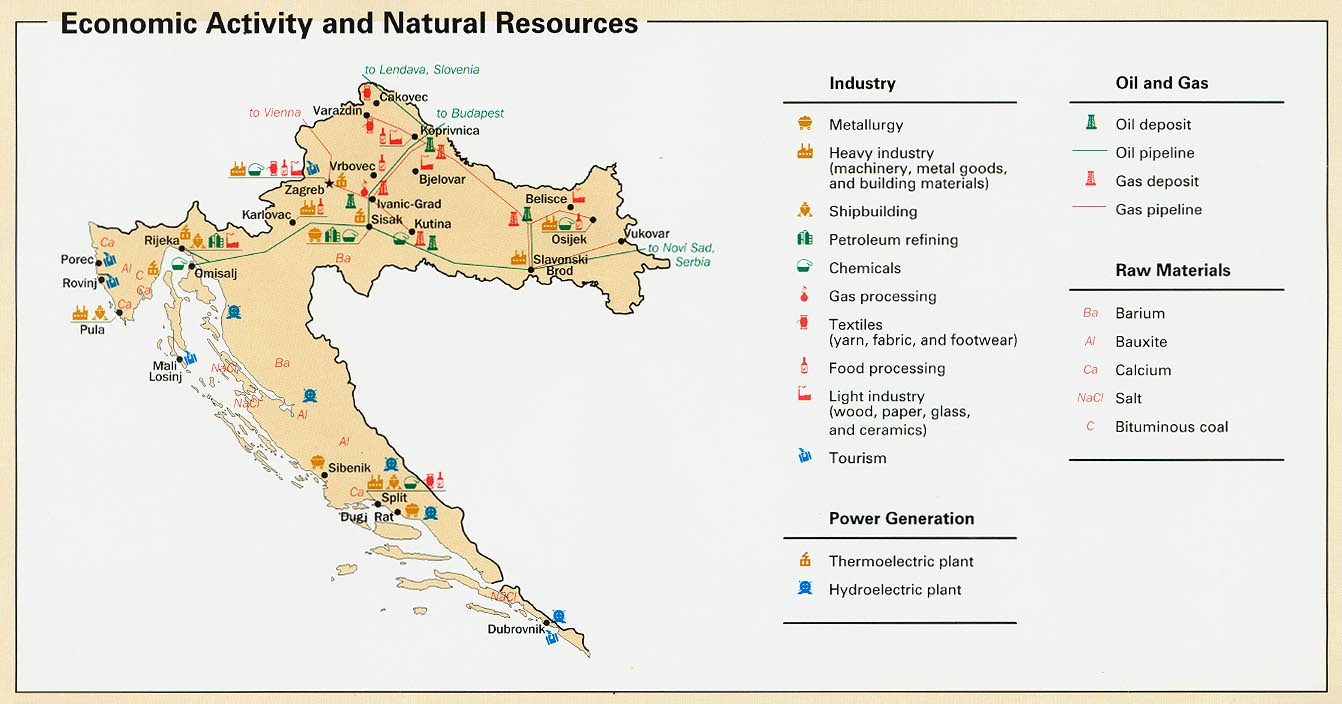
| Croatian economic activity and natural resources map, 1996 JPEG image, 1342 x 704 pixels |
Economic activity and natural resources | |
| Ethnic groups in the South Eastern Europe JPEG, 640 x 565 pixels |
Ethnic groups in the SE Europe | |
| Land mines in the Balkans JPEG, 511 x 486 pixels |
Land mines in the Balkans | |
| Refugees and displaced people from the former Yugoslavia since 1991 JPEG, 736 x 700 pixels |
Refugees and displaced people | |
| Karta Čakovca Map of Čakovec |
Hrvatski Deutsch English | |
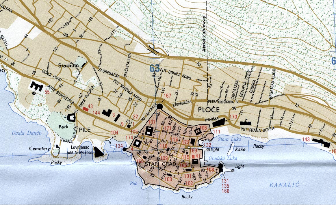
| Map of the Dubrovnik Area Clickable shockwave flash map of Dubrovnik and the surrounding area. |
Dubrovnik Area | |
| Map of Dubrovnik, 1995 JPEG image, 1163 x 710 pixels |
Map of Dubrovnik | Legend |
| Međimurje Karta Međimurske zupanije sa prikazom svih mjesta. |
Međimurje | |
| Karta Međimurske županije GIF image, 780x566 pixels |
Karta Međimurja | |
| Digitalna karta Osijeka | Digitalna karta Osijeka | |
| Karta Požege | Karta Požege | |
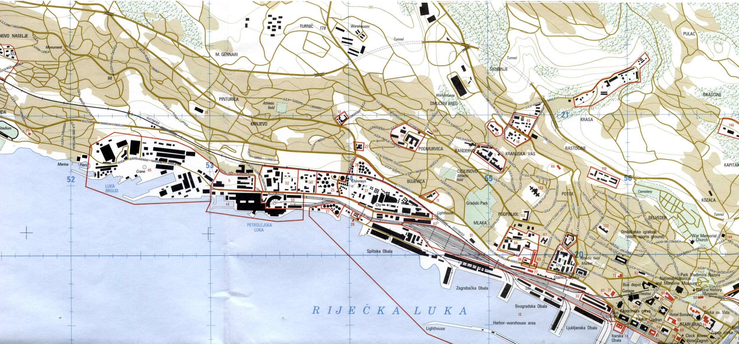
| Interaktivna karta Rijeke | Karta Rijeke | |
| Map of Rijeka JPEG image, 2500x1164 pixels |
Map of Rijeka | |
| Map of Šolta JPEG image, 551x462 pixels |
Šolta | |
| Map of the Varaždin Region | Varaždin Region Map | |
| Mapa Visa Map of Vis |
Hrvatski | English |
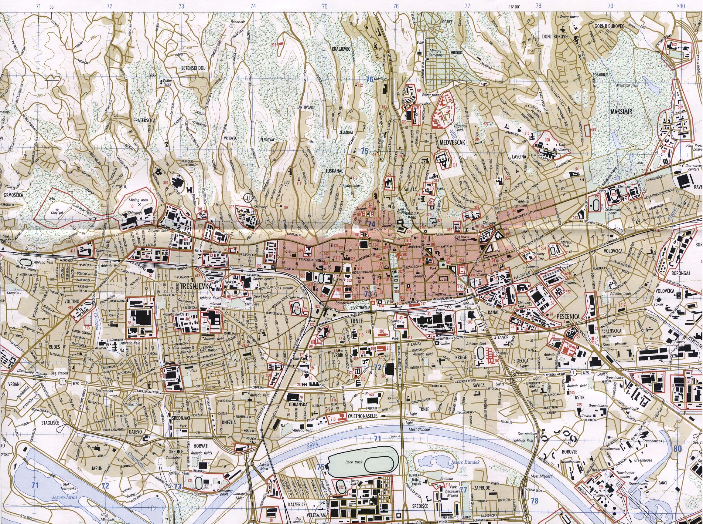
| Karta Zagreba Map of Zagreb Detaljna geogafska i auto mapa grada Zagreba sa važnim lokacijama. / Detailed map of Zagreb with all major locations. |
Hrvatski English | |
| Karta Zagreba | Karta Zagreba | |
| Karta Zagreba, Zagreb Karta Zagreba: zumirajte u vlastitu ulicu, zgradu ili dvoriste! Karta Grada Zagreba je detaljnija i preciznija od ostalih karta. Karta Grada Zagreba |
Karta Zagreba | |
| Zagrebačka županija: Cestovna mapa | Zagrebačka županija | |
| Zagrebačka županija JPEG image, 668x471 pixels |
Zagrebačka županija | |
| City Map of Zagreb 103K road map of Zagreb. (1510 x 1375 JPEG) |
City Map of Zagreb | |
| Zagreb, 1995 JPEG image, 2315x1728 pixels, showing a detailed map of Zagreb |
Zagreb | |
| Zagreb, 1995 Reference pages for Zagreb map listed above. |
Page 1 | Page 2 |
| MapZones.com : Croatia Map A poor map, but good information about Croatia below the map. |
MapZones.com : Croatia Map | |
| Flags and Arms of the Modern Era A large database of Vexillological information on countries of the world. |
Hrvatski | English |
| The FAME: Index | Hrvatski | English |
| The FAME: Croatia | Hrvatski | English |
| Grb Republike Hrvatske Coat-of-arms of Republic of Croatia Information about the Croatian GRB, in Croatian and English. |
Hrvatski Grb | |
| Zastave hrvatskih županija Flags of Croatia's Counties Flags of the different regions of Croatia, coupled with historic information. |
Hrvatski | English |
| Zastave hrvatskih gradova Flags of Croatian Cities Flags of different Croatian cities, with specs and background information |
Hrvatski | English |
| Zastave hrvatskih općina Flags of Croatian Districts Flags of Croatian districts with specs and other information. |
Hrvatski | English |
| Druge zastave Hrvatske Croatia - other flags The flags presented here are those that are seen in Croatia frequently. |
Hrvatski | English |
| Separatističke zastave Hrvatske Croatian Separatist Flags Flags used by members of F-YU in anticipation that parts or all of Croatia would become part of a greater serbia. |
Hrvatski | English |
| Administrativna podjela Hrvatske kroz povijesti Subdivisions of Croatia through history Traces Croatia's divisions and counties through recent history. |
Hrvatski | English |
| Flag of the Republic of Croatia A look at Croatia's current flag and coats of arms in use today. |
Australia I | Australia II |
| Belgium | France | |
| Israel | Italy | |
| Italy II | Sweden | |
| U.K. | U.S.A. I | |
| U.S.A. II | U.S.A. III | |
| Flag of the Croatia's counties The Republic of Croatia is divided in 21 counties. They are administrative units, and each has a coat of arms and flag. |
Australia I | Australia II |
| Belgium | France | |
| Israel | Italy | |
| Italy II | Sweden | |
| U.K. | U.S.A. I | |
| U.S.A. II | U.S.A. III | |
| Croatian Flag Related Legislation | Australia I | Australia II |
| Belgium | France | |
| Israel | Italy | |
| Italy II | Sweden | |
| U.K. | U.S.A. I | |
| U.S.A. II | U.S.A. III | |
| Povijesne zastave Hrvatske Historic Flags of Croatia |
Hrvatski | English |
| Zastave Dubrovačke Republike, 1272.-1808. Flags of the Republic of Dubrovnik, 1272-1808 |
Hrvatski | English |
| Hrvatske administrativne jedinice u Austro-ugarskoj Croatian subdivisions in Austria-Hungary |
Hrvatski | English |
| Povijesni Hrvatski Grbovi Croatian historic coats of arms |
Hrvatski | English |
| Croatia, history of the flag A historical and vexillological look at Croatia's flag, plus some interesting new proposals since 1991..... |
Australia I | Australia II |
| Belgium | France | |
| Israel | Italy | |
| Italy II | Sweden | |
| U.K. | U.S.A. I | |
| U.S.A. II | U.S.A. III | |
| Flags of Croatia Small GIF images that can be used on web sites. |
Flags of Croatia | |
| Zastave NDHa Flags of NDH |
Hrvatski | English |
| Položajne Zastave NDHa Rank Flags of the Independent State of Croatia |
Hrvatski | English |
| Pomorski plamenica NDHa Naval Pennants of the Independent State of Croatia |
Hrvatski | English |